
.png)

Welcome to the Falkland Islands
Escape on the Ultimate Island Adventure!
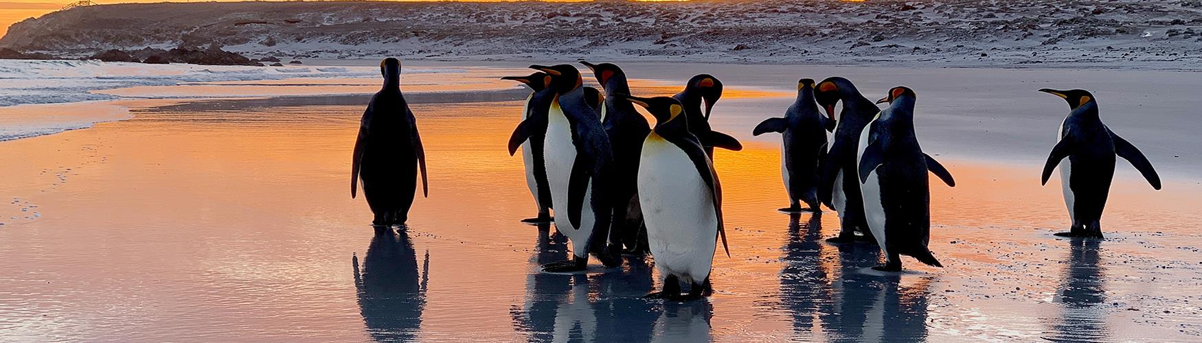
Welcome to the Falkland Islands - an incredible archipelago of stunning white sand beaches, seas of beautiful blues and sparkling aquamarines, rocky crags and untouched landscapes.
Imagine ..... nature in the raw, with animals and birds, basking, calling, playing, enjoying this exquisite environment, chosen as home.
Imagine ..... a place that is so far off the beaten track that you have this all to yourself.
Imagine ..... a silence that is only broken by the sounds of the wildlife, the oceans, and your own footsteps as you explore these amazing islands in the South Atlantic Ocean.
The Falkland Islands are one of the last great wilderness destinations where your trip becomes an adventure. Four-wheel drives are our mode of transport, and our little planes will take you to islands abundant with penguins, albatrosses and petrels that are there for you alone to discover and enjoy.
At the end of each day you can look forward to traditional cosy Falkland Islands' hospitality in the hotels, lodges and guesthouses scattered around the islands.
What are you waiting for?
Come ..... explore ..... relax ..... enjoy ..... escape ..... on the ultimate island adventure.
.jpg)


Follow, Like, Love
Follow The Falklands @ilovethefalklands
Like The Falklands on Facebook
Follow The Falklands @FITBTourism
TWITTER UPDATES